
Participants at the 9th Pan-African Congress in Lomé discussed a rarely addressed issue with profound implications: the representation of Africa on the world map.
In line with the international ‘Correct the Map’ campaign, they called for this visual perception, inherited from centuries of Eurocentric cartography, to be corrected.
The ‘Correct the Map’ campaign denounces the widespread use of the Mercator projection, invented in the 16th century by Flemish cartographer Gerardus Mercator. This projection, designed for maritime navigation, distorts land areas: countries close to the equator appear smaller than they really are, while regions at high latitudes (Europe, North America, Russia) appear disproportionately large.
As a result, Africa, the world’s second largest continent with an area of 30 million km², appears visually smaller than Europe or Greenland, when in fact it is 14 times larger than the latter.
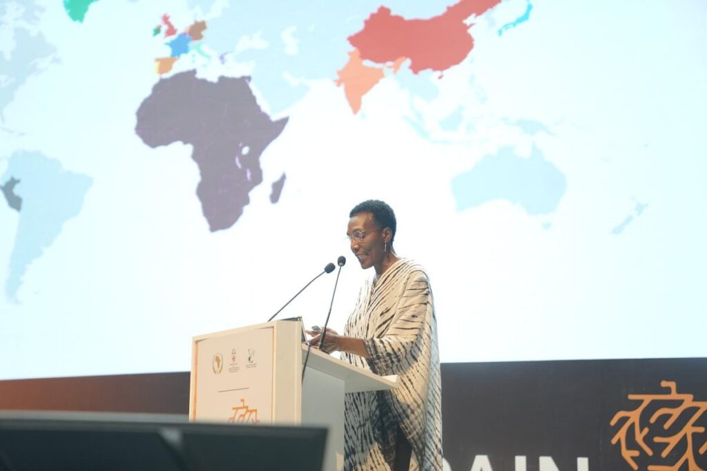
For Robert Dussey, Togo’s Minister of Foreign Affairs, this biased representation fuels a distorted perception of power relations and greatness. ‘Correcting the map also means correcting our view of Africa and its role in the world,’ he told the assembled delegations.
The minister emphasised the symbolic but strategic nature of this fight: doing justice to Africa means recognising its true geographical, demographic and economic place on the world stage.
Launched by African and Afro-descendant academics, artists and activists, ‘Correct the Map’ aims to promote alternative map projections, such as the Gall-Peters projection, which better reflects the actual proportions of land masses.
The campaign advocates not only for changes to school and political maps, but also for a revision of collective imaginaries, where Africa still too often appears marginalised.